Hike to Sweden's Old City

In the early 1800s, there was a cluster of farms at the base of Black Mountain. These farms disappeared as people moved west to farm more fertile lands or to seek a better life.
Little of these farms remain except for stone walls and crumbling stone foundations.
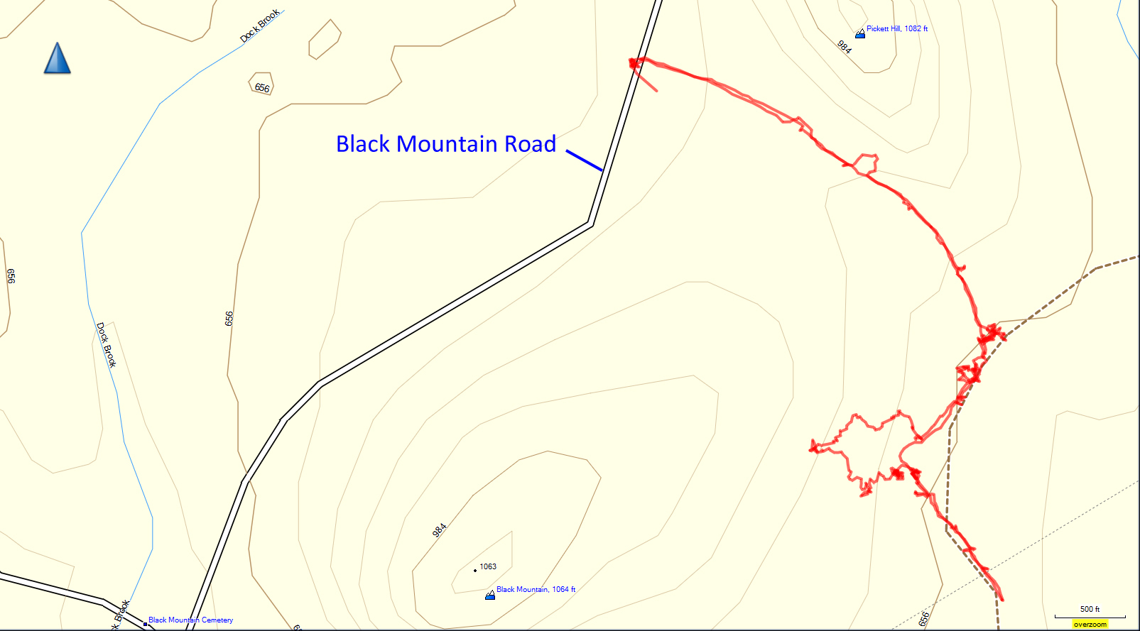
The map below shows the trail from GPS data.


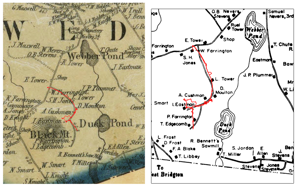
The trail superimposed on the 1858 map (original) and redrawn map. The original map and the trail show remarkable correspondence (see below).

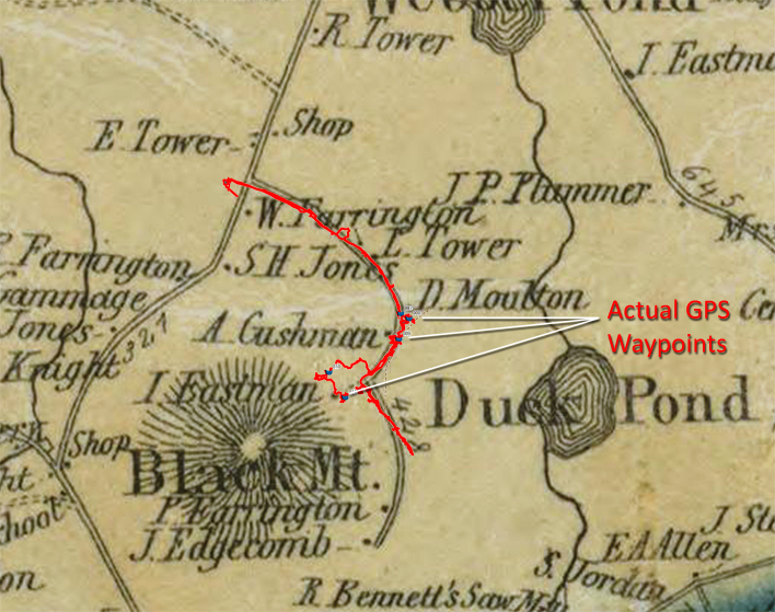
To further illustrate the correspondence between the GPS output and the original 1858 map, this map shows the waypoints recorded at the house sites. Note how closely they match the Moulton, Cushman, and Eastman sites.
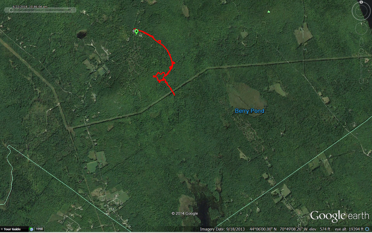
The trail shown on Google Maps is not that interesting since it is mostly under tree cover, but here it is:

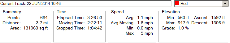
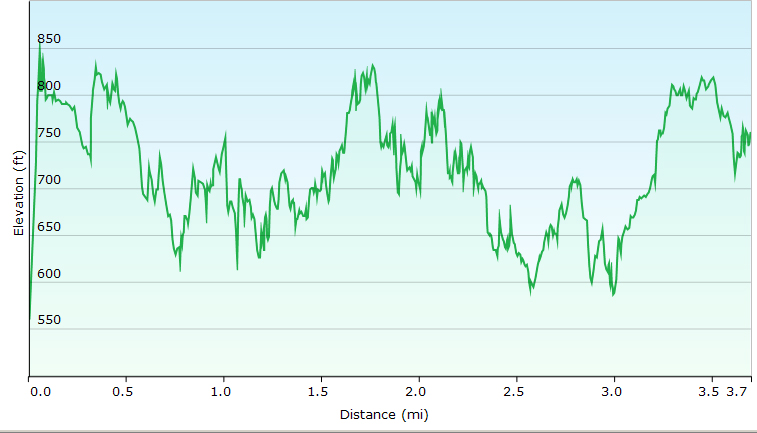
Trail Data and Elevations
Notes:
  • We found many ragged robin wildflowers (Lychnis flos-cuculi). This plant is native to Europe but has become naturalized in the northeast US. See photos below.
  • We were surprised to see a striped maple heavily laden with seeds. Striped maples are common, but I have never seen one like the one shown below.
  • We surprised a grouse, who was apparently guarding a nest or young  since it flew up at us and went back to the nest on the ground, not away. She was making sad, crying sounds, so we quickly turned and left her alone.
  • Then we were watching some little green fluorescent bugs on the ground when a few inches away, a hermit thrush flew up - probably out of its nest. Obviously this area is not frequently traveled.
Moulton site foundation
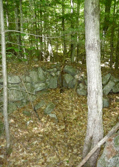
www.EskerRidge.com